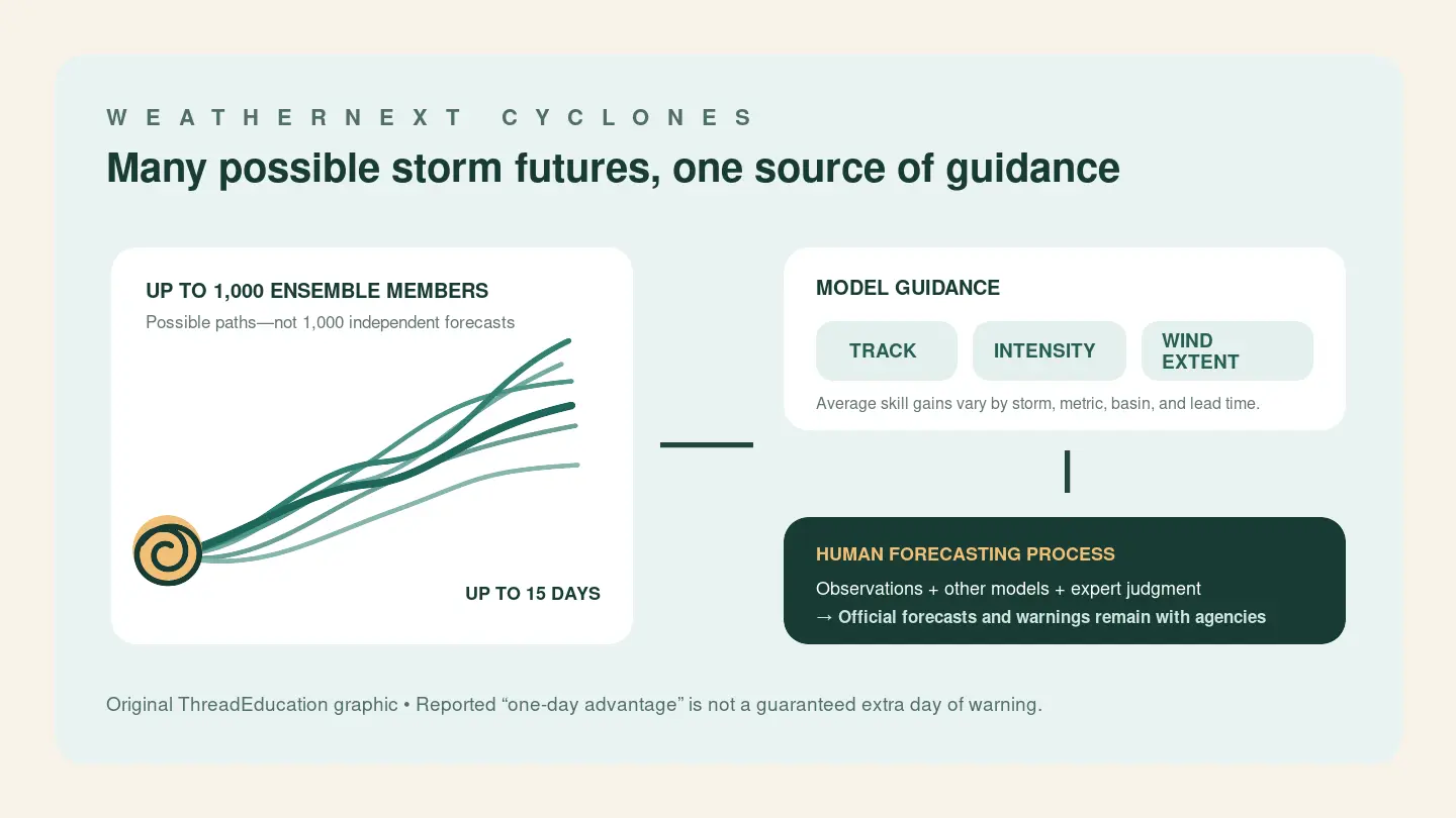
Google DeepMind’s latest weather model can generate forecasts for the track, intensity and size of tropical cyclones around the world, up to 15 days ahead. In retrospective tests covering storms from 2023 and 2024, its predictions reached a given level of accuracy at least a day earlier on average than leading operational models across the metrics evaluated. A separate 2025 checkpoint received only a partial evaluation in National Hurricane Center basins.
That result, reported in an early-access Nature paper and announced on August 6, 2026, is a meaningful advance in computer-generated hurricane guidance. It is not a promise that every storm can be predicted 24 hours sooner. It does not give coastal residents a guaranteed extra day to prepare. And it does not turn an experimental artificial-intelligence model into an official forecast or warning.
Those distinctions are essential to understanding WeatherNext Cyclones. The system matters not because it replaces hurricane forecasters, but because it could give them another strong source of evidence to weigh alongside other models, observations and expert judgment.
What “one day earlier” really means
Forecast models are commonly compared by asking how their errors grow with lead time. A three-day forecast is usually less accurate than a two-day forecast because the atmosphere has had another day to evolve and small uncertainties have had more time to spread.
WeatherNext Cyclones, or WN-C, shifted that relationship in the authors’ evaluation. Across the tested measures of track, intensity and wind radii, the model showed an average lead-time advantage of a day or more over leading operational models. Google DeepMind described the result this way: a WN-C forecast at three days had about the accuracy earlier models reached at two days.
This is a comparison between average skill levels, not a new clock attached to every forecast. Performance can vary by storm, ocean basin, metric and lead time. A strong average does not mean every three-day WN-C prediction beats every two-day prediction from another system. It certainly does not mean that emergency managers will always receive a reliable public warning one day sooner.
The model’s 15-day horizon needs the same care. Producing an output at that range is not the same as producing useful hurricane detail at every point through day 15. Long-range ensemble forecasts can help describe possible scenarios and uncertainty even when precise storm details remain unresolved.
A thousand possible futures
WN-C is an ensemble model. Rather than producing only one projected future, it can generate as many as 1,000 members—different realizations that sample how a cyclone and the surrounding atmosphere might evolve. The conventional ensembles used in the paper’s comparison contained 50 members.
More members can represent a wider range of plausible outcomes and help forecasters judge how concentrated or dispersed the possibilities are. If most members cluster along a similar path, that conveys something different from an ensemble that fans across a broad region.
But 1,000 is not a multiplier for accuracy. It does not make the system 20 times as accurate as a 50-member ensemble, and many members can still share weaknesses inherited from the same model and input data.
The model was trained on global atmospheric analyses and a historical tropical-cyclone database. Its notable technical result is that one coarse-grid global system performed strongly not only on the large-scale problem of storm track, but also on intensity and wind structure, which are more difficult to resolve.
The paper also reports that adding WN-C to a weighted consensus improved the consensus. That may be the more operationally relevant result. Hurricane centers already compare and combine multiple sources of guidance; a model can be valuable by making that collective picture better, without being treated as an oracle.
Guidance enters a human forecasting process
The National Hurricane Center began incorporating AI models into real-time operations during the 2025 season. In its verification preview, the agency called the Google DeepMind guidance—identified operationally as GDMI—“very useful.” It also cautioned that some AI systems were not consistently available early enough for routine use.
The version released as a 0.25-degree checkpoint ran live during the 2025 Atlantic season under the identifier FNV3; NHC used a postprocessed form called GDMI. That operational exposure goes beyond a purely retrospective test. But it should not be confused with independent validation: NHC scientists are among the paper’s co-authors, while the agency’s separate public verification preview offers qualitative rather than complete quantitative evidence.
NHC model output is guidance. The agency issues official center-position and maximum sustained-wind forecasts every six hours, extending through 120 hours. Forecasters consider model runs alongside observations, other guidance and their own analysis before producing the public forecast.
That division was visible during Hurricane Melissa in 2025. Google says WN-C helped NHC, but the agency’s storm discussion shows forecasters blending GDMI with other guidance and judgment. The model did not independently issue the warning or determine the forecast.
Open tools with important boundaries
DeepMind released model code, pretrained weights and a smaller version with one-degree resolution in the WeatherNext repository. The code and notebooks use the Apache 2.0 license, while other repository materials use Creative Commons Attribution 4.0.
That does not mean every ingredient needed to reproduce the training process is unrestricted. Training and operational input datasets carry their own terms. The repository also says the smaller model is not expected to match the full models, and describes the release as experimental and unsupported. It is not a government-endorsed public warning product.
These caveats do not erase the achievement. Tropical-cyclone forecasting requires models to handle large-scale atmospheric steering, changes near the storm’s core and the evolving reach of damaging winds. Strong ensemble guidance across all three areas could improve the information available to forecasters, especially when it strengthens a consensus rather than merely adding another competing line on a map.
The next measure of progress will be repeated operational verification: whether the model arrives on time, remains skillful across seasons and basins, and adds useful information when combined with established systems. WeatherNext Cyclones has cleared an important research test and gained real-time experience at NHC. The public promise should remain narrower: better guidance for experts, not an automatic extra day of warning for everyone in a storm’s path.